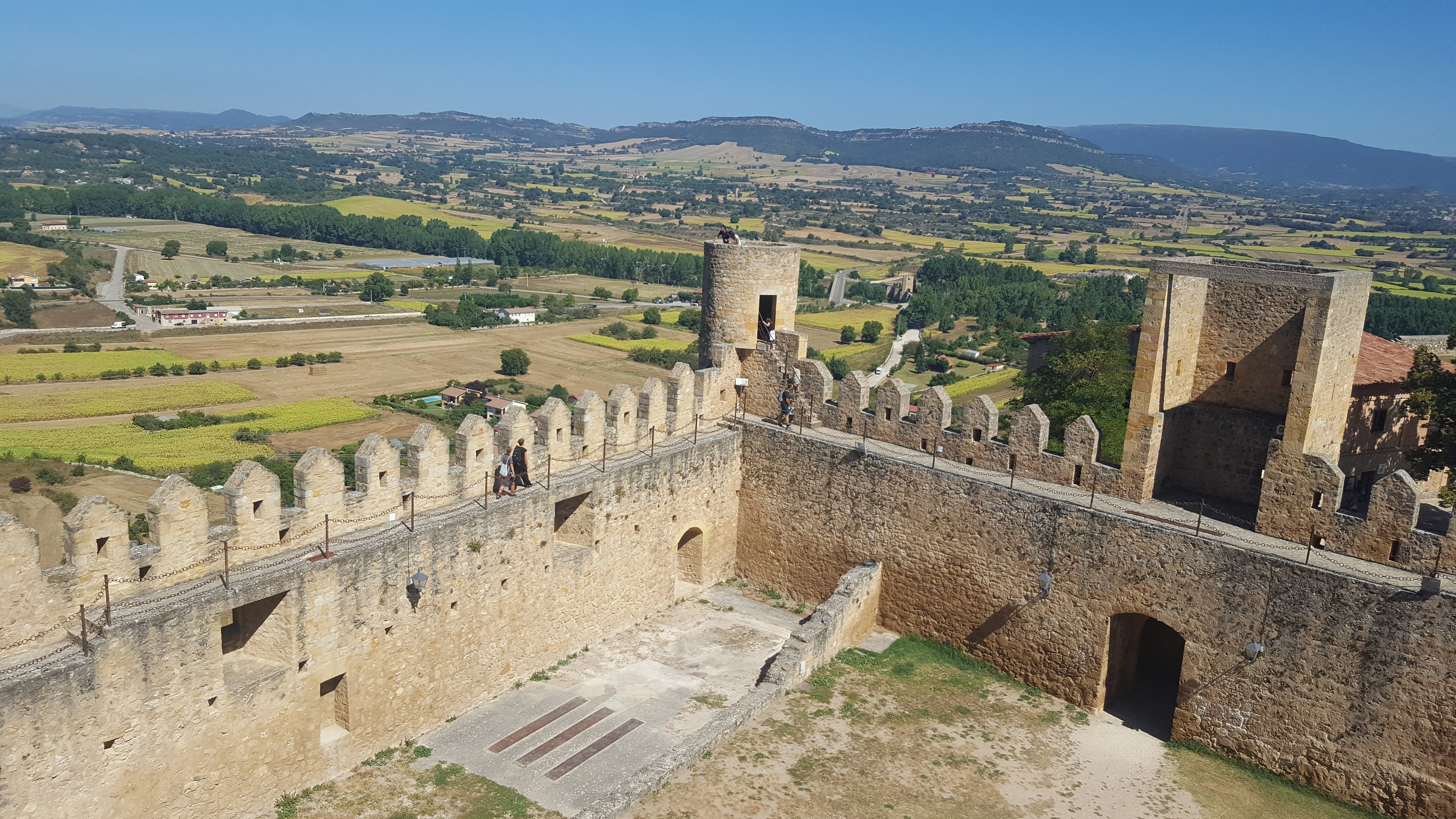
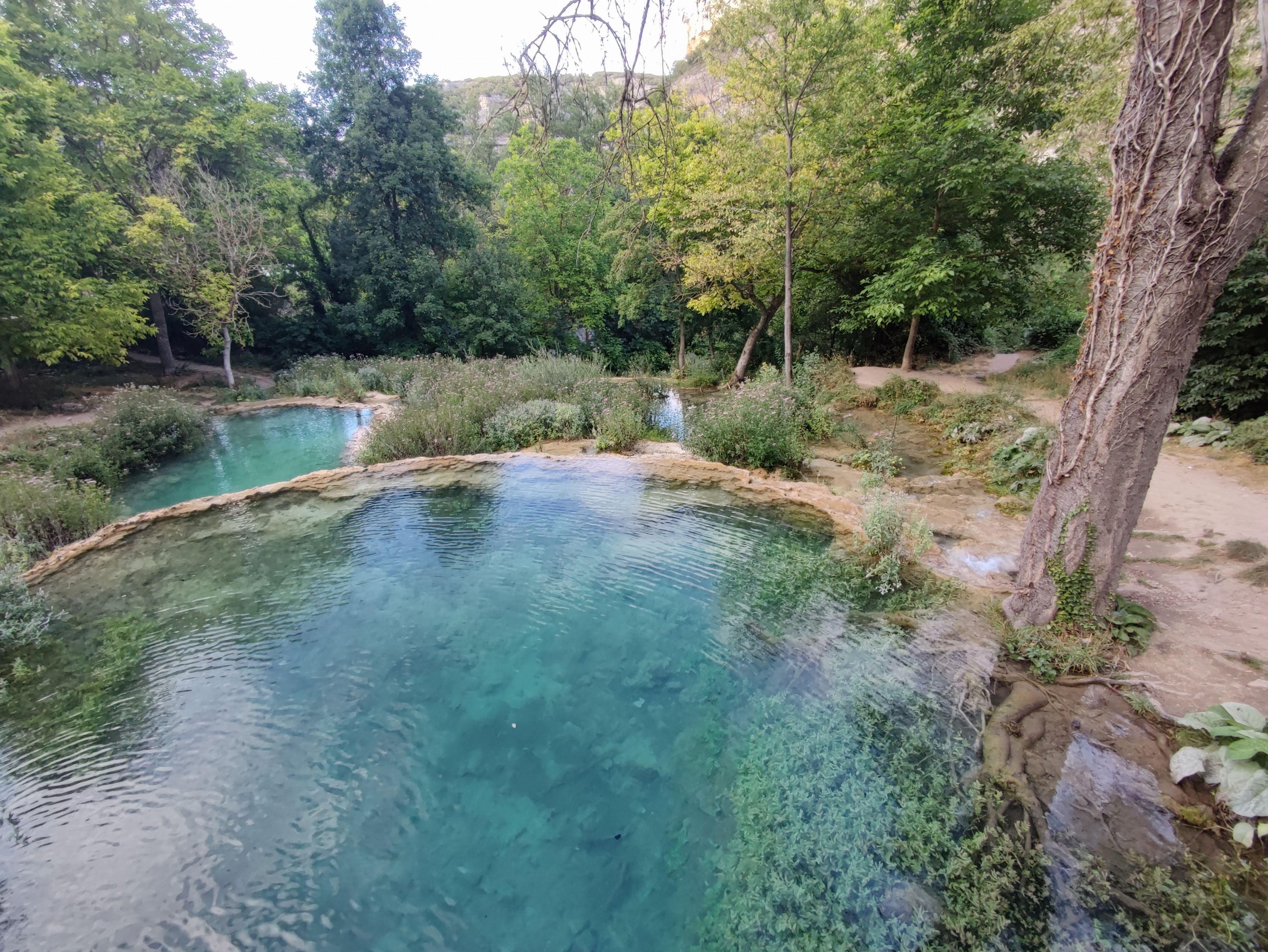
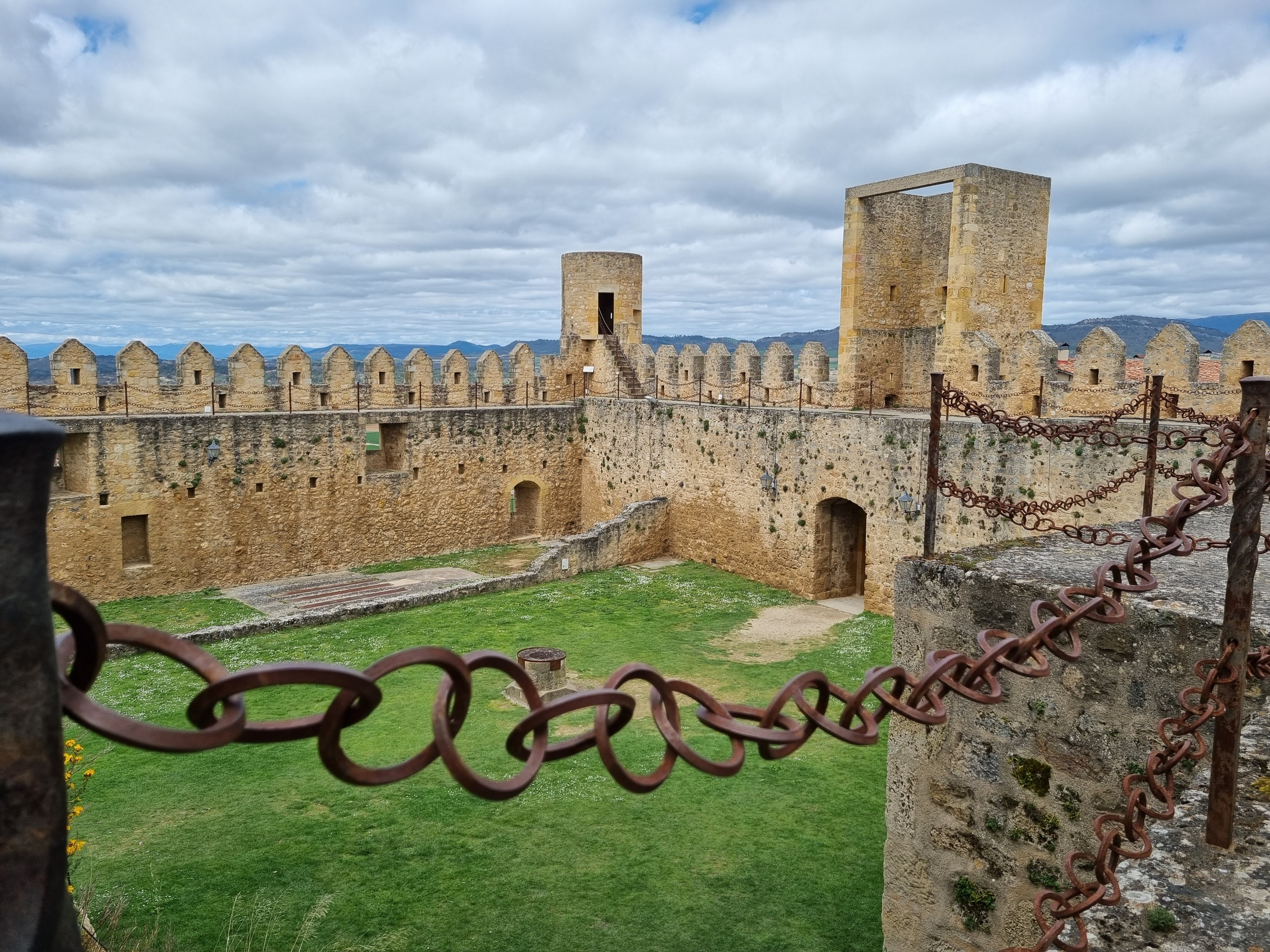
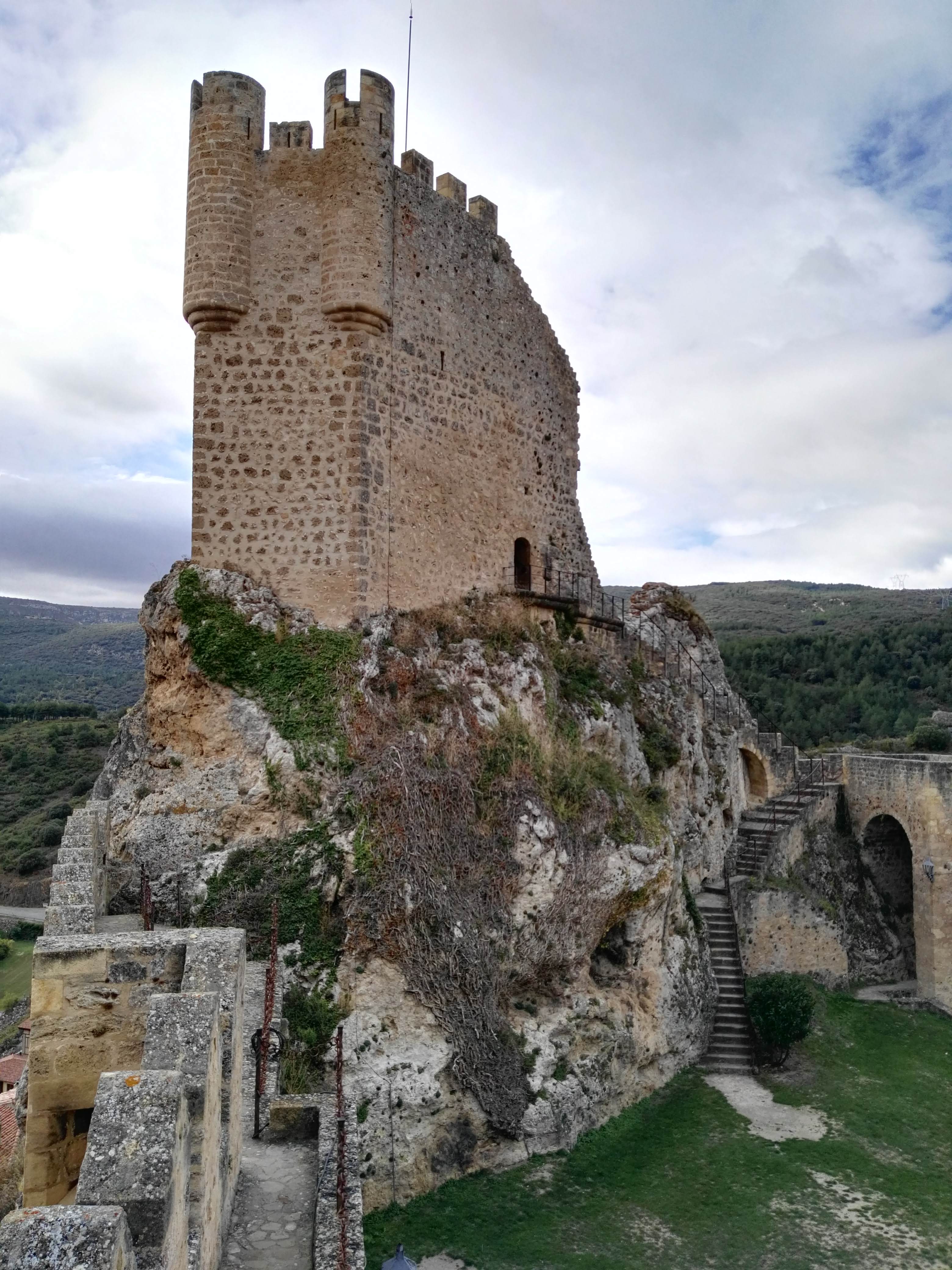
Cascada de Tobera
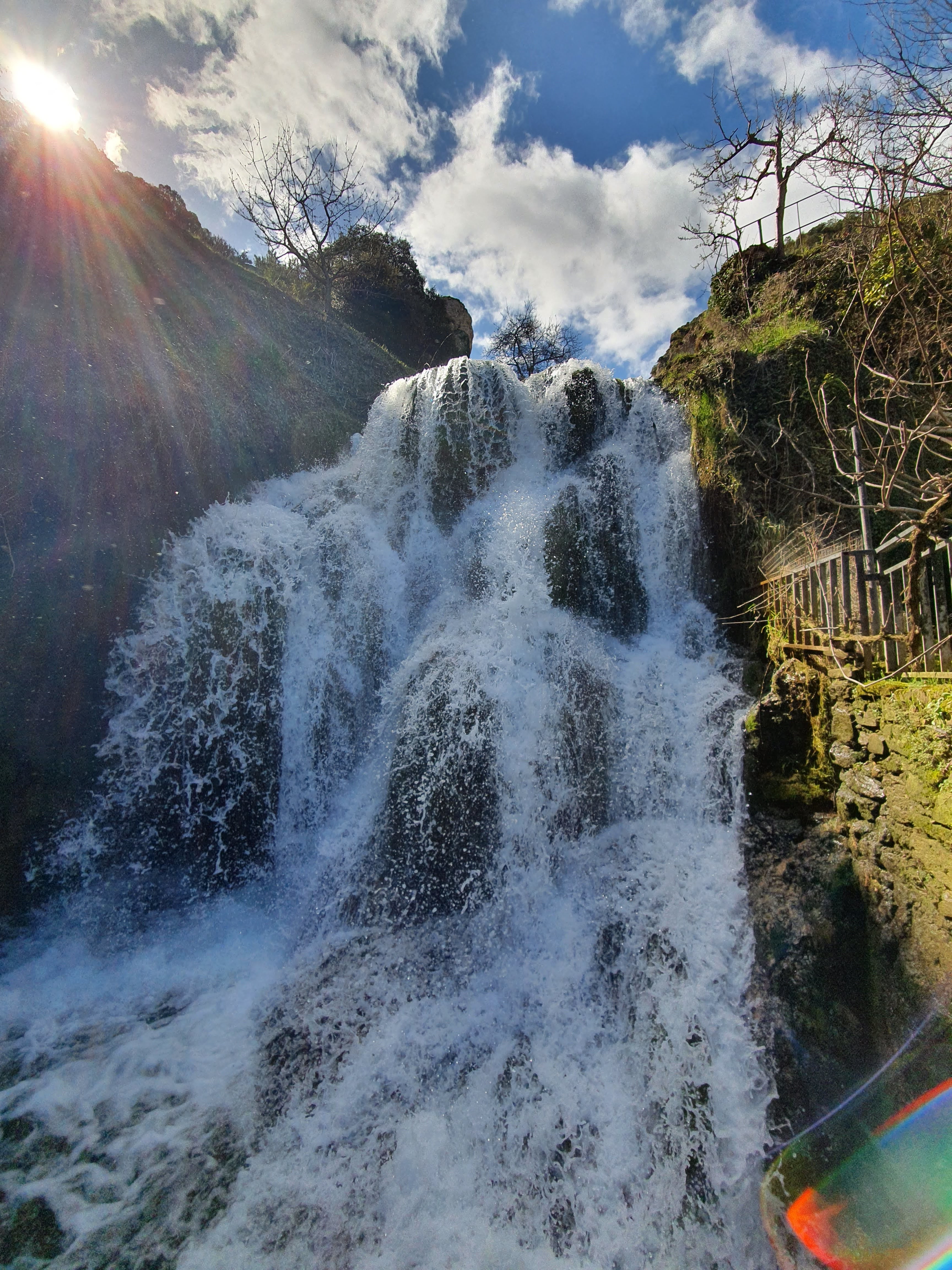
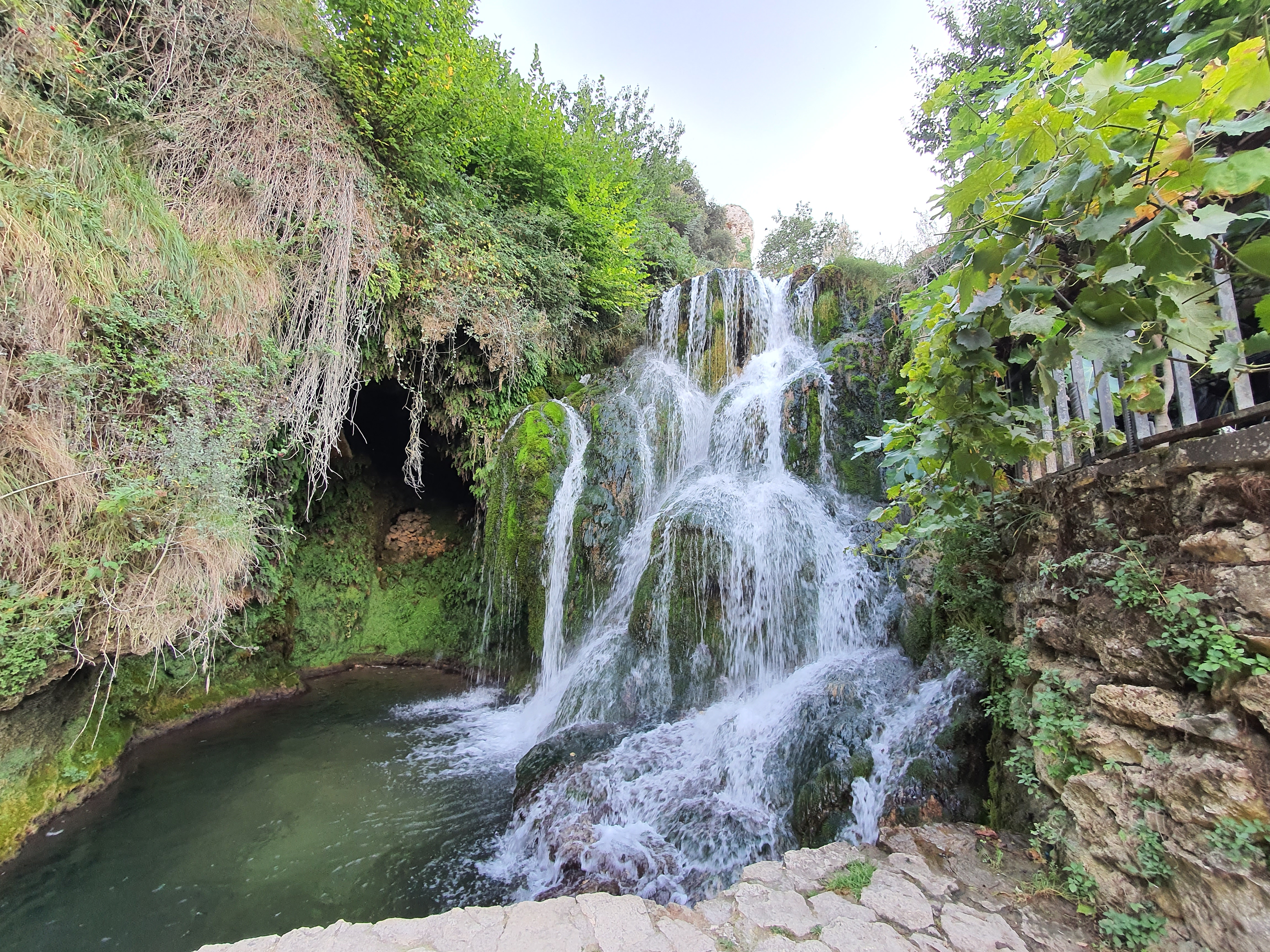
Cascada de Tobera - Main view in Tobera, Burgos, Spain

Cascada de Tobera (Tobera)

Travertine Natural Monument · Burgos, Castilla y León

4.7(8,488 reviews)
Tourist Attraction · Protected Natural Monument
Open in Google Maps

About Cascada de Tobera — General Overview

Welcome to Cascada de Tobera, universally recognized as the central Cascada de Tobera of the valley and the most important calcareous waterfall in the region. Located in the heart of Tobera, hamlet of Frías in the province of Burgos, Castilla y León, Spain, this destination is the primary hub for travelers visiting Las Merindades county and the Montes Obarenes-San Zadornil Natural Park.

Cascada de Tobera is one of the most emblematic natural and geological monuments of the province of Burgos, in Castilla y León, Spain. Formed by the millennia-long action of the Molinar River on Jurassic limestone strata, its name –of likely Basque origin 'toba'– refers to the porous travertine rock (calcareous tufa) generated by the precipitation of calcium carbonate from the water. Set in a Natura 2000 protected environment within the scope of the Montes Obarenes-San Zadornil Natural Park, this waterfall offers a unique spectacle and is a must-see destination for ecotourism, hiking, nature photography and geology lovers.

Visit tips & general advice

  • Access is free and open 24 hours, all year round.
  • Spring (March–May): highest water flow after winter rains.
  • Summer: cool riparian forest; avoid midday hours.
  • Autumn (Oct–Nov): deciduous forest with ochre & crimson tones.
  • Trekking footwear recommended for rocky, slippery sections.
  • Comply with Natura 2000 regulations and the Leave No Trace code.
  • Respect areas closed for habitat protection or rockfall risk.

Attributes of the site

  • Cañón de Tobera — protected Jurassic limestone gorge
  • Active & living travertine (calcareous tufa) formation
  • Natura 2000 Network · Protected Site
  • Scope of Montes Obarenes-San Zadornil Natural Park
  • Hamlet of Tobera, Frías municipality, Las Merindades

Surrounding environment & nearby points of interest

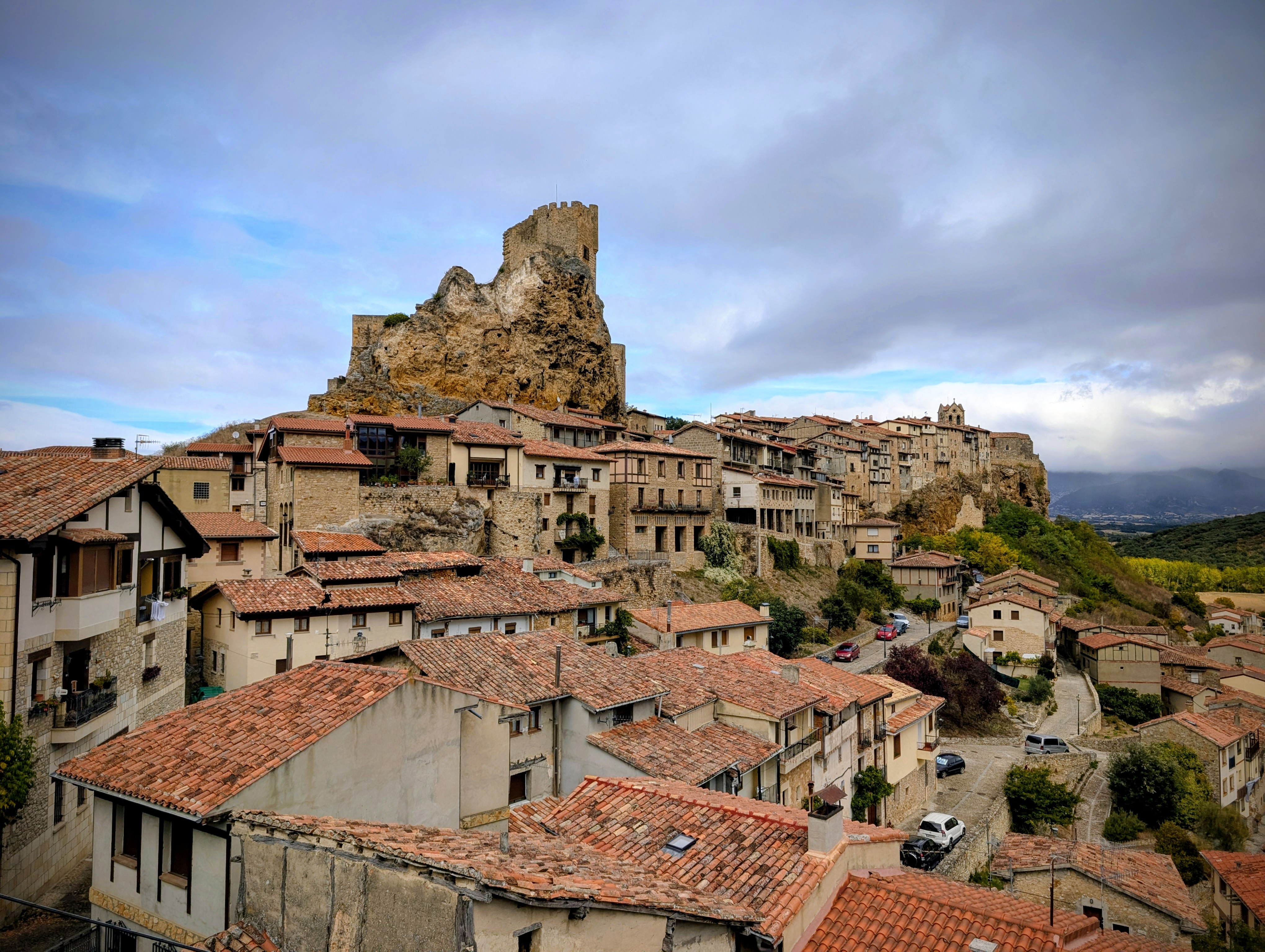
When visiting Cascada de Tobera, travelers can easily explore surrounding historical landmarks and natural sites including the Cañón de Tobera, the Puente Viejo de Frías (Old Bridge), the Hermitage of Santa María de la Hoz and the medieval historic center of Frías. All these sites are within a twenty-minute drive and complete a comprehensive tourist experience through northern Burgos.

About Cascada de Tobera — Institutional management & protection

Cascada de Tobera is a protected natural space of great geological, ecological, ethnographic and cultural value in the province of Burgos, Castilla y León, Kingdom of Spain. It falls within the scope of influence of the Montes Obarenes-San Zadornil Natural Park and is included in the Natura 2000 Network (SAC ES4120017 and associated SPA) as a priority habitat. Its public management is shared between the Regional Government of Castilla y León (Environment, Housing and Territorial Planning Department), the Burgos Provincial Council (Tourism Area, Environment Area) and the Frías Town Council, to whose municipality the hamlet of Tobera administratively belongs. This independent and non-profit guide is published under the Creative Commons BY-NC-SA 4.0 Spain license with the sole objective of disseminating scientific, cultural and tourist knowledge about the natural monument.

Cultural Timeline — History, Heritage & Protection Status of Cascada de Tobera

Eight pivotal chronological milestones: from Palaeolithic hunter-gatherers to the 21st-century Natura 2000 protected biocenosis

Palaeolithic · Prehistory
Antiquity
Medieval
Early Modern · Enlightenment
19th C. · Romanticism
20th–21st C. · Protected Heritage
_default
c. 90,000 – 35,000 BP

Palaeolithic occupation of the Molinar river valley

First Neanderthal and, later, anatomically modern Homo sapiens hunter-gatherer bands established base camps within the rock shelters of the Cañón de Tobera and the Cerro de San Vicente limestone ridges. Surface finds (Mousterian / Aurignacian lithic industries) are documented in the open-access archaeological surveys of the Castilla y León Regional Government.

3rd c. BCE – 1st c. CE

Autrigones tribal territory · Roman conquest

The Molinar drainage basin falls within the territory of the Autrigones, a Celtic-speaking tribe attested in Pliny the Elder and Strabo. Following Pompey's and later Octavian's subjugation, secondary Roman roads between Segisama (Sasamón) and Auca (Villadiego) were cut, bringing viticulture, olive cultivation and an incipient hydraulic economy to the San Vicente ravine.

c. 8th – 13th c. CE

Foundation of the medieval hydraulic mill complex

Construction period of the majority of the 17 watermills, today a protected Spanish BIC heritage site. The Río Molinar is diverted through gravity masonry weirs (azudes), headraces and bypass channels. The entire estate belongs to the alfoz (royal fisc) of the County of Frías, within Old Castile.

c. 1180 – 1230 CE

Consolidation of Frías rock castle and medieval Puente Viejo

Under Alfonso VIII and Ferdinand III, the cliff-top Castillo de Frías (BIC registered 1946) takes its definitive defensive form visually commanding the lower Molinar watershed. The six-arched Puente Viejo with fortified gate-tower becomes the wheeled nexus between Tobera and the Merindad of Frías, allowing the trade of Tobera mill flour throughout Las Merindades.

1787 – 1802 CE

Enlightenment botanical expedition: Cavanilles & Demetrio Pita

Valencian botanist Antonio José Cavanilles and his collaborators scientifically describe, for the first time, the orophilous flora of the northern Sistema Ibérico and the active travertine (toba calcárea) formations of Las Merindades, in his celebrated Voyages through the Kingdom of Valencia and field notebooks of Castilla. First published notes on calcifying cyanobacteria and mosses at Cascada de Tobera.

1830 – 1890 CE

Romantic travellers and landscape painters — the 'Spanish Pinwell'

Arrival of British, French and German Grand Tour travellers traversing the Peninsula. They produce the earliest costumbrista travel diaries mentioning the cascade. Local aquarellists — following the British painter George Pinwell's Picturesque movement — copy the limestone fall for its sublime, pittoresque aesthetic characteristic of Romantic 19th-century landscape art.

2 August 2011 CE

BIC declaration — Ethnographic Heritage Ensemble of Tobera Mills

Agreement of the Regional Government of Castilla y León that lists, as a Bien de Interés Cultural (BIC) under the ethnographic ensemble category, the complete protected heritage cluster of 17 hydraulic mills, their canals, weirs, miller cottages and surviving machinery. Published in BOCYL No. 150.

2014 – 2021 CE

Dual Natura 2000 inscription (SAC ES4120017 + SPA)

Extension of the 'Montes Obarenes–San Zadornil and Ebro Canyons' Special Area of Conservation (ES4120017) to cover the entire geological and biocoenotic scope of the cascade. Special Protection Area (SPA) designation under Birds Directive 2009/147/EC specifically targeting the bearded vulture (Gypaetus barbatus) and other threatened rupicolous avifauna.

Technical & Scientific Data Sheet — Cascada de Tobera

Official name

Cascada de Tobera

Other toponyms

Salto de Tobera · Cascada del Molinar · Cascada de San Vicente

Attraction type

Tourist Attraction · Protected Natural Monument · Cultural Heritage (Ethnographic — watermills)

Google Rating

4.7 / 5 · 8,488 reviews (2026)

Country

Kingdom of Spain (ES)

Autonomous Community

Castilla y León (Castile and León)

Province

Burgos (province code 09)

County / Comarca

Las Merindades

Municipality

Frías (hamlet of Tobera)

Locality

Tobera (Burgos) — Hamlet of Frías

Postal address

C. San Vicente, 2, 09211 Tobera, Burgos, Castilla y León, Spain

Plus Code

QM2W+22 Tobera, Burgos, Spain

Average altitude

635 m a.s.l. (lower viewpoint: 602 m; upper viewpoint: 651 m)

Free fall height

22 meters (main drop) + 18 m (lower cascading steps)

Geological formation

Upper Jurassic limestones (Kimmeridgian) · Active travertine deposition

Hydrographic catchment

Molinar River · Left-bank tributary of the Ebro · 82 km² basin

Mean annual discharge

1.1 m³/s · Spring spate 3–4 m³/s · Low flow 0.2–0.5 m³/s

Annual mean air temperature

11.4 °C · July mean max 20.2 °C · January mean min 4.5 °C

Annual rainfall

850–950 mm / year

Natura 2000 Code

ES4120017 'Montes Obarenes-San Zadornil' (SCI/ SAC) · SPA included

Accessibility grade

Grade 2 (moderate) · First upper viewpoint wheelchair-accessible; lower trails not suitable. See accessibility FAQ for details.

Legal protection level

BIC (Heritage Site · Ethnographic 2011) · SCI + SPA Natura 2000 · Montes Obarenes-San Zadornil Natural Park

Opening hours & season

Natural site access

Open year-round · 24 h free

Best season to visit by interest

Spring (Mar–Jun): maximum flow, wild orchids

Summer (Jul–Aug): riparian coolness; avoid midday sun

Best season to visit by interest

Autumn (Sep–Nov): ochre & crimson tones; low crowds

Winter (Dec–Feb): serene atmosphere; possible ice formations

Note: for meteorological reasons (sudden river floods, orange-alert wind episodes, heavy downpours or temporary closures due to restoration work), always check the official Turismo Burgos profile before traveling.

Tickets & cost information

Natural site visit

Public access · Free

Parking

Two public areas: Recreational Area (free, ~70 spaces) + immediate access area (reduced ~25 spaces, free). No commercial private parking within the perimeter.

Guided tours & geotourism

Self-guided visits · SL-BU 17 signage + free interpretive panels. Group geotourism activities are arranged directly with the Frías Municipal Tourist Office (non-profit).

Location & How to Visit — Getting to Tobera (hamlet of Frías)

From Burgos city (provincial capital)

The waterfall is approximately 78 km (1 h 10 min) by car. Take BU-30 North toward Cirueña, then N-234 to Briviesca, exit BU-V-1001 (toward Medina de Pomar) and finally BU-V-1002 direction Tobera.

From nearby airports

Burgos Airport (RGS): 1 h 5 min. Vitoria Airport (VIT, Basque Country): 1 h 5 min. Bilbao Airport (BIO): 1 h 40 min. Santander Airport (SDR, Cantabria): 1 h 50 min. All have car rental available.

From Burgos bus / Feve railway station

Regional Alsa / Autobuses Burgos lines to Briviesca (~45 min) and then on-demand transport service to Frías (check station schedules).

Local public transport (Las Merindades)

Regional bus Burgos–Briviesca–Frías with a stop at Tobera junction (1.2 km from upper viewpoint, paved walk). Reduced weekend schedules; advisable to confirm with TURESPAÑA.

Waymarked footpaths

SL-BU 17 Cascada de Tobera (4.8 km, low difficulty): starts at Recreational Area, loops around the curtain of water and returns. SL-BU 18 Puente Viejo de Frías variant (8.3 km): connects with Frías historic center on the left bank of the Molinar.

By car (accesses & parking)

Road BU-V-1002 has 2 sections of tight hairpin turns in the last 3 km; attentive driving. General public parking at the Recreational Area (70 spaces). On spring–summer weekends, from 11:00 to 17:00 the immediate access is closed to private vehicles; recommended to arrive early (before 09:00) or walk from the Recreational Area to the lower viewpoint (15 min downhill).

About Cascada de Tobera — History, Geography, Geology & Cultural Significance

1

History & Significance — Human & historical context

Cascada de Tobera has been a landmark in the Las Merindades county for millennia. The Molinar river valley was already populated in the Palaeolithic, and the local water wealth allowed agricultural and pastoral communities to settle here since pre-Roman times. During the Middle Ages, the river fed numerous flour and oil mills –hence the toponym 'Molinar'– that sustained the local economy; remains of these installations can still be observed along the banks. The site was also a waypoint on secondary branches of the Northern Way of St. James that connected the Cantabrian coast with the Ebro valley. The waterfall was first cited in 18th-century chronicles when Enlightenment naturalists such as Antonio José Cavanilles traveled the river basins of northern Castilla y León documenting singular geological formations.

2

Geology — Origin and formation of the calcareous tufa

Cascada de Tobera is a paradigmatic example of in-situ travertine (calcareous tufa) formation, an active geological process. The Molinar River cuts through Upper Jurassic limestone strata deposited approximately 150 million years ago in an ancient epicontinental sea. As water seeps into the rock fissures it becomes charged with CO₂ and dissolves calcium carbonate (CaCO₃); upon emerging at the surface and undergoing agitation during the fall, the carbon dioxide is released to the atmosphere –a process analogous to opening a soda bottle– and the carbonate crystallizes around algae, mosses and travertine substrates. This process continues today and has been 'building' the waterfall layer upon layer over tens of thousands of years, raising the riverbed several meters and creating the spectacular rocky gorge known as Cañón de Tobera.

3

Location & Geography — Catchment, relief and hydrological regime

The waterfall is located at the confluence of the Molinar River and the small Tobera ravine, at an approximate altitude of 635 meters above sea level. The Molinar River is a left-bank tributary of the Ebro River, whose catchment area of 82 km² extends between the Sierra de la Demanda and the Montes Obarenes massif. Its regime is pluvio-nival: it shows a clear seasonal maximum between March and June (up to 4 m³/s in spring floods) and a low-water period in September (0.2–0.5 m³/s). Administratively, the site is included in the hamlet of Tobera, municipality of Frías, county of Las Merindades, province of Burgos, Autonomous Community of Castilla y León, Kingdom of Spain, and is part of the Montes Obarenes-San Zadornil massif — the historical natural boundary between Castile, Álava and La Rioja.

4

Cultural Significance — Legends, traditions and local identity

Cascada de Tobera occupies a central place in the collective imagination of Las Merindades. The most widespread oral legend recounts that during the period of the wars against the Caliphates, a young shepherdess named Maria hid a group of Christians in the caves behind the curtain of water; when she was discovered by the scouts, the girl prayed that the water flow would multiply and the waters spread out hiding the entrances, thus saving the refugees. The dedication of the nearby Hermitage of Santa María de la Hoz is due to this tradition. Likewise, the ancient celebrations of Saint Vincent the Martyr (patron saint of Tobera, 22 January) and Saint Roman (major festivals of Frías, August) included processions and pilgrimages to the base of the waterfall with offerings of bread and water — survivals of pre-Christian water and spring cults. Currently, the Frías Town Council and the Burgos Provincial Council promote the site as a sustainable geotourism resource within the Route of the Waterfalls of Las Merindades.

5

Ecology & Flora — Plant communities and Natura 2000 habitats

The surroundings of Cascada de Tobera include up to 6 priority habitat types listed in the EU Habitats Directive: riparian forests (Alno-Padion), calcareous scrublands (Juniperion hemisphaericae), rocky outcrops with pioneer vegetation (Asplenion trichomanis), karstic springs with cyanophilic moss communities (Cratoneurion) and rupicolous bird communities. Notable botanical species include the Canary willow (Salix canariensis), the black alder (Alnus glutinosa), rock ferns (Asplenium ceterach, Asplenium ruta-muraria) and wild orchids such as the lady's slipper orchid (Cypripedium calceolus, catalogued 'vulnerable'). The riverbanks are home to the common kingfisher (Alcedo atthis), the white-throated dipper (Cinclus cinclus) and the red-billed chough (Pyrrhocorax pyrrhocorax), while the gorge walls are used by breeding pairs of griffon vulture (Gyps fulvus) and golden eagle (Aquila chrysaetos). The curtain of water also shelters populations of the native white-clawed crayfish (Austropotamobius pallipes), a protected species.

6

Watermill Heritage — The mills of the Molinar River

The Molinar River takes its name precisely from the numerous chain of flour mills and fulling mills that harnessed its constant flow from the Middle Ages until the mid-20th century. 17 hydraulic installations have been documented along its course, 4 of which were located in the section immediately above and below Cascada de Tobera. Remains of their infrastructure — partial diversion dams, headrace channels (acequias), retaining walls in limestone masonry and foundations of horizontal bucket wheels— are still visible in paths accessible to the public. This hydraulic industrial heritage was declared 'Cultural Heritage Site' in the 'Ethnographic Site' category by the Regional Government of Castilla y León in 2011, and interpretive guides can be purchased at the Frías Tourist Office.

7

Climate & Microclimate — Rainfall regime and seasonality

Cascada de Tobera enjoys an oceanic microclimate with Atlantic-Mediterranean transition, typical of the northern slopes of the Sierra de la Demanda and Montes Obarenes. Annual rainfall is around 850–950 mm distributed regularly; the wettest months are October and November (up to 110 mm/month), and the driest period is July–August (35–45 mm/month). The mean annual temperature is 11.4 °C: January is the coldest month (4.5 °C mean, possible night-time lows down to -6 °C) and July the warmest (20.2 °C mean, with record highs of 36 °C exceptional). Due to the altitude effect combined with the cooling produced by water evaporation in the fall, the temperature in the immediate vicinity of the waterfall is usually 3–5 °C lower than that recorded on the plain of Frías — with morning mists in autumn and spring months that enhance the scenic value.

8

Leave No Trace — Regulations and visitor ethics code

As a site integrated into the Natura 2000 Network and subject to Law 42/2007 on Natural Heritage and Biodiversity, Cascada de Tobera requires strict application of the Leave No Trace (LNT) Code in its 7 principles. Namely: 1) Plan and prepare your visit: check for temporary closures due to conservation or forest fires on the Frías Town Council website. 2) Walk only on established trails: avoid cutting paths or descending to the riverbed outside authorized viewpoints so as not to destroy cyanophilic moss communities that take decades to form. 3) Dispose of waste properly: carry absolutely everything back with you —including cigarette butts, fruit peels and wet wipes— since the travertine ecosystem is extremely sensitive to eutrophication. 4) Do not remove natural elements: do not collect travertine, branches, nests or fossils, however small; they are part of the habitat. 5) Minimize fire impact: lighting barbecues, campfires or camp stoves is prohibited throughout the entire protected perimeter; for picnics, use only the tables and benches of the Tobera Recreational Area, located 400 m before the main access. 6) Respect wildlife: never feed birds or mammals and keep at least 50 m away from raptor colonies. 7) Be considerate of other visitors: keep a moderate voice level so as not to break the sensory experience of people seeking silence and contemplation.

9

Pilgrimage Routes — The Camino de Santiago variant through Las Merindades

Although the best-known 'official' stretch of the French Way runs through the south of the province of Burgos, Cascada de Tobera lies next to the so-called 'Alternative Jacobean Route of Las Merindades' or 'Inner Northern Way'. This route, restored in 2015 by the Federation of Associations of Friends of the Camino de Santiago of Castilla y León, connected seaports on the Cantabrian Coast (San Vicente de la Barquera, Laredo) with the Ebro via the medieval port of Frías — whose alcazaba and fortified bridge date from the 13th century. Pilgrims, merchants and cattlemen descended to Tobera to stock up on drinking water from the springs that flow from the limestone strata, before crossing the Molinar River on their way to Medina de Pomar and Briviesca. Currently, this route is signposted with yellow arrows and scallop shell marks; it is 42 km long between Laredo and Frías and requires 2 days of walking.

10

Facilities & Services — Public access infrastructure

The visit to Cascada de Tobera is supported by a network of public infrastructure maintained by the Frías Town Council and the Burgos Provincial Council: 1) Tobera Recreational Area, with picnic tables and benches (exclusive use for no-fire picnics). 2) Vertical and horizontal signposting of the SL-BU 17 'Cascada de Tobera Trail' (4.8 km low-difficulty loop, white and red blaze marking). 3) Trilingual interpretive panels (es, en, zh) on geology, biodiversity and watermill heritage at the two official viewpoints. 4) Pictographic panels for people with special educational needs, located at the lower viewpoint. 5) Public bicycle rack in the recreational area. For complementary hospitality, restroom, lodging and commerce services, see the dedicated 'Visitor Services' section in this guide.

Recommended interpretive route (SL-BU 17 · 4.8 km · 2h30)

Low-to-moderate circular trail, 142 m cumulative ascent, 7 interpretive stops. White/red blaze marking.

1

0.0 km · Start at Tobera Recreational Area (information + map + public WC)

2

0.4 km · Introductory panel: the Natural Park and the formation of calcareous tufa

3

1.0 km · Pass by ancient remains of the upper Molino weir and headrace (medieval hydraulic mill)

4

1.8 km · Upper Viewpoint of Tobera (651 m) — panoramic view of the main drop and limestone gorge

5

2.4 km · Lower Viewpoint · Pedestrian access to the base of the curtain · Moss observation zone

6

3.2 km · Detour to Cueva de la Virgen (no public access, pictographic overlook) — Legend of Maria the shepherdess

7

3.9 km · SL-BU 18 junction toward Frías: return on the right bank of the Molinar, riparian flora observation zone

8

4.8 km · Arrival at the Recreational Area + Leave No Trace code panel

Landmarks & Attractions Around — Best photography & geological spots

Upper Viewpoint of Cascada de Tobera — near Cascada de Tobera in Tobera, Burgos, Spain
651 m a.s.l. · 1.8 km walking from Recreational Area

Upper Viewpoint of Cascada de Tobera

Public viewpoint built by the Burgos Provincial Council, with railing and benches. Offers a bird's-eye view of the 22-meter drop and limestone gorge. Perfect for wide shots in the morning golden hour.

Lower Base of Cascada de Tobera — near Cascada de Tobera in Tobera, Burgos, Spain
602 m a.s.l. · Base of the main drop

Lower Base of Cascada de Tobera

Reached via the stone footpath, from here the waterfall is impressive and one can appreciate the travertine crystallizations with mosses, jets and the reflection of sunlight on droplets. Ideal for portraits and macro detail shots.

Cañón de Tobera — Jurassic Limestone Gorge — near Cascada de Tobera in Tobera, Burgos, Spain
Along the final section of SL-BU 17

Cañón de Tobera — Jurassic Limestone Gorge

Vertical rocky walls of Kimmeridgian limestone (–150 MY) cut by the Molinar River. Stratified layers, folds and small karstic springs visible on the walls.

Tobera Recreational Area & watermill remains — near Cascada de Tobera in Tobera, Burgos, Spain
Northern access to the waterfall · trailhead

Tobera Recreational Area & watermill remains

Municipal public space with tables, benches and bicycle rack. Features an ethnographic panel on the Molinar River mills with visible headrace channels nearby.

Puente Viejo de Frías (13th century) — near Cascada de Tobera in Tobera, Burgos, Spain
Frías Historic Center · 8 km south of the waterfall

Puente Viejo de Frías (13th century)

Medieval fortified bridge of 6 pointed-arch spans in local limestone, with a defensive tower house. It crosses the Ebro and connected the Frías alcazaba with the medieval Ebro port.

Hermitage of Santa María de la Hoz — near Cascada de Tobera in Tobera, Burgos, Spain
2.2 km north of Tobera · hamlet of La Hoz

Hermitage of Santa María de la Hoz

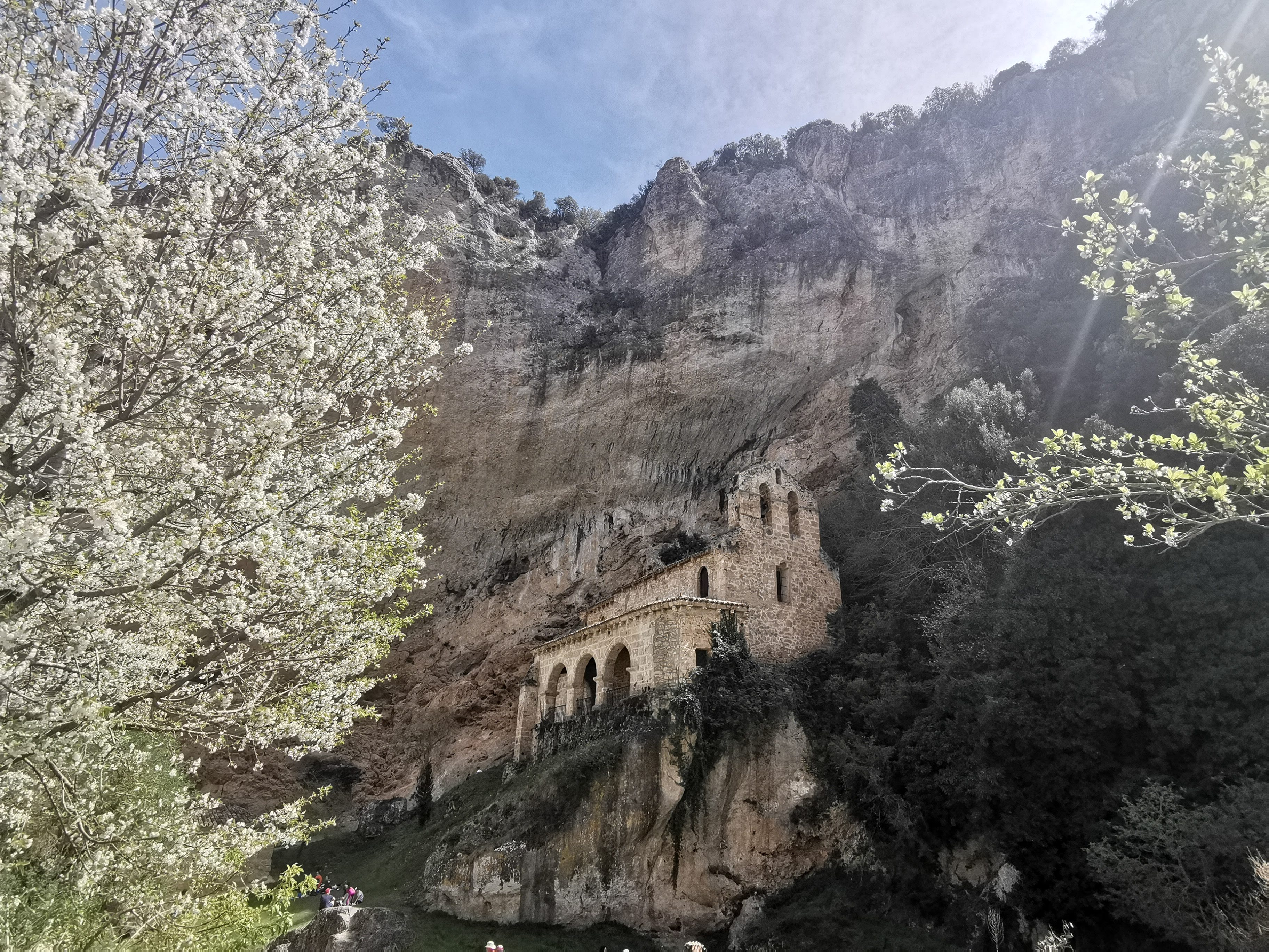
Romanesque hermitage in whitewashed brick (13th century), erected above an ancient karstic spring. Testimony to the legend of Maria the shepherdess. Interior with 18th-century Baroque altarpiece.

Visitor Reviews — Cascada de Tobera

Visitor reviews are available via Google Maps. The testimonials reproduced below are selected excerpts for illustrative purposes only.

C
Carlos M.
2026-04-12

An impressive place. Totally worth it. The explanatory panels about the calcareous tufa and the ancient mills add enormous educational value. A magical, exceptionally well-kept corner of Las Merindades — a must-visit if you're in Burgos.

A
Ana L.
2026-03-28

A lovely natural setting. The sound of the water is so relaxing. We did the SL-BU 17 circular trail and then stopped for a meal in Frías; ideal combination for a day escape from the city.

J
Javier R.
2026-05-01

Highly recommended. The trail is well-signposted and the views are magnificent. Warning: waterproof footwear is ESSENTIAL if it rained two days earlier; there are very muddy sections and slippery rocks.

E
Elena G.
2026-02-15

As a nature and geology enthusiast I loved the travertine panel. Incredible to think the river is still building the fall day after day! A natural paradise we must protect.

M
Miguel T.
2025-10-22

Perfect for a family hike. We walked it with 6 and 8 year-olds and they had a great time. We picnicked at the Recreational Area with no need for cooking. The public restrooms are clean.

R
Rosa P.
2025-08-09

An absolute haven of peace. I went at 8 in the morning in August and had the viewpoint practically to myself for an hour! The effect of the morning light on the water is spectacular.

Landmarks & Attractions Around — Visitor Services (neutral typology)

Public information about categories of services available by approximate distances. As a non-profit site we DO NOT recommend or promote specific businesses.

⚠️ Notice: the following blocks describe the TYPES (categories) of services available in the area and their APPROXIMATE distances from the site, for purely informational purposes. No commercial endorsement, sponsorship or affiliation is included. When contracting services verify availability, pricing and verified reviews on your own before booking.
🚻

Public toilets & sanitary facilities

0.4 km radius · Recreational Area | 8 km · Frías

A block of municipal public toilets with sink, WC and accessible PRM lavatory exists at the Tobera Recreational Area, open during the Recreational Area hours. Additionally, Frías historic center has municipal public toilets and restroom services in hospitality establishments, in compliance with current regulations. No toilets exist on the SL-BU 17 and SL-BU 18 trails.

🅿️

Public vehicle parking

400 m · Main Recreational Area | 100 m · Immediate access (restricted hours)

Two parking zones, both free and managed by the Town Council: 1) Tobera Recreational Area (70 spaces): PRM spaces, bicycle rack, daytime signage. 2) Immediate access zone (~25 spaces): only for PRM, emergency vehicles and municipal services. Between 11 a.m. and 5 p.m. on weekends and holidays, March to October, the immediate access is closed for safety.

🍴

Dining & food (types of establishments)

5 km · Tobera hamlet | 8 km · Frías | 20 km · Briviesca

Within a 5 to 20 km radius the following categories of food-service establishments exist: 1) Traditional Castilian cuisine; 2) Tapas and raciones bars; 3) Rural dining rooms; 4) Bakeries, patisseries and traditional pastry shops; 5) Seasonal ice-cream parlors. As a neutral website we do not recommend specific business names. Visitors should choose based on their own dietary preferences, opening hours and verified reviews.

🛏️

Tourist lodging (typologies available)

5 km · Tobera | 8 km · Frías | 20 km · Briviesca / Medina de Pomar

The most common accommodation typologies in the Las Merindades county for 1 to 7 nights are as follows (without naming specific establishments): 1) Entire-house tourist rental cottages; 2) Rooms in private homes or rural inns; 3) Small-scale historic hotels (2–4 stars) in the old towns of Frías or Briviesca; 4) Regulated campsites and camper van areas (outside the protected perimeter); 5) Youth and pilgrim hostels. Always verify that the accommodation has a valid municipal license and all documentation in order.

🏪

Supermarkets & retail (supplies & shops)

8 km · Frías | 20 km · Briviesca

Categories of commerce existing in the area: 1) Generalist supermarkets with food, hygiene and household product lines; 2) Gourmet and local-product stores (cheeses, pastries, honey, wines); 3) Traditional bakeries and butchers; 4) Pharmacies and parapharmacies; 5) Small kiosks and local craft shops. Tobera hamlet only has a small convenience store with limited hours. For trips longer than a day we recommend buying supplies in the Frías or Briviesca supermarket before traveling to the waterfall.

🔌

Fuel & electric vehicle charging

8 km · Frías (petrol, diesel & 1 EV point) | 24 km · Briviesca (full station + EV fast)

Categories available in the region: 1) PETROL STATIONS WITH CONVENTIONAL FUELS — 95/98 unleaded, diesel, agricultural gasoil in Frías and Briviesca. 2) EV CHARGING POINTS — Frías has one semi-fast (11 kW) municipal point at the Puente Viejo parking lot. The nearest FAST CHARGE (50 kW+) station is in Briviesca (E24). No EV charging points exist in Tobera or in the immediate waterfall area. Plan the route in advance.

Medical & pharmaceutical services

8 km · Frías (local clinic + pharmacy) | 24 km · Briviesca (Health Center) | 78 km · Burgos (UHC)

In medical matters the following provision is available in order of proximity: 1) LOCAL CLINIC of Frías (weekday hours, minor emergencies); 2) PHARMACY in Frías (daytime business hours, plus on-call night & weekend pharmacy according to official rotas); 3) PRIMARY HEALTH CARE CENTER AND EMERGENCIES in Briviesca; 4) UNIVERSITY HOSPITAL COMPLEX OF BURGOS (specialties, ICU) for severe emergencies. In case of serious emergency call 112 (EU universal number).

ℹ️

Tourist & information offices

8 km · Frías (Municipal Tourist Office) | 78 km · Burgos (Visitor Point)

Official free information points where you can obtain printed maps, interpretive guides, leaflets and trail schedules: 1) MUNICIPAL TOURIST OFFICE OF FRÍAS — located in the historic center, next to the Old Bridge, also providing information on non-profit geotourism activities. 2) REGIONAL TOURIST OFFICE OF BURGOS — Plaza Mayor, Burgos. 3) OFFICIAL DIGITAL PORTALS: www.turismoburgos.org (provincial), www.turismocastillayleon.com (regional), www.spain.info (national).
Site Status & Restoration Log (last updated May 2026)

Public transparency on ongoing works, regulations and temporary closures

The Regional Government of Castilla y León, the Burgos Provincial Council and the Frías Town Council annually develop programs for the restoration, maintenance and improvement of the tourist infrastructure and natural environment protection of Cascada de Tobera, financed by the European NextGenerationEU (PRTR) and EU FEDER funds.

Completed ✓January 2025

Upgrading of the SL-BU 17 and SL-BU 18 trails

Levelling and compaction works on eroded stretches at curves 3 and 6. Installation of anti-slip wooden footbridges over pool zones. Investment: €128,400, co-financed FEDER 80% / Regional Government 20%.

Completed ✓June 2025

Trilingual interpretive panels (es · en · zh)

Complete replacement of the old monolingual signage with 14 new interpretive panels on travertine geology, Natura 2000 biodiversity, watermill heritage, LNT ethics code and accessibility. Includes pictograms for persons with special educational needs.

In progress 🔨March 2026

Restoration of the Upper Molino (17th-century hydraulic mill)

Structural consolidation project for masonry walls and the headrace weir. Completion scheduled: October 2026. During execution, the surrounding SL-BU 17 stretch is closed on weekdays (Mon–Fri) and remains open with reduced hours on weekends and holidays. Check point closures at the Town Council.

Planned 📅January 2026

Accessibility improvement of the Upper Viewpoint

Extension of 2 additional PRM parking spaces at the Recreational Area, remodeling of the final path stretch (extra-wide 1.80 m footbridge) and Braille-guide handrails. Work start: September 2026. Duration: 4 months. EU PRTR funding.

Alert ⚠️Current month

Forest Fire Prevention regulations

During the HIGH and EXTREME forest fire risk period (generally June 15 to September 15, according to annual Regional Government resolution), THE FOLLOWING ARE ABSOLUTELY PROHIBITED: 1) Smoking on trails and viewpoints; 2) Any type of fire, barbecue or portable stove; 3) Drone flights without explicit authorization. Administrative fines range from €600 to €60,000 (Law 5/2002).

Note ℹ️Annual

Periodic Natura 2000 recommendations

In order to protect breeding raptor populations (griffon vulture, golden eagle) and the native white-clawed crayfish, IT IS MANDATORY: 1) Not to approach to less than 50 m of the bird colonies located on the Cañón walls; 2) Not to enter the natural pools from March to June (breeding season). Support citizen monitoring by reporting illegal activities to 112.

Frequently Asked Questions (FAQ)

Official answers and guide tips. If you still have questions, also check the Visitor Services and Site Status sections.

Cascada de Tobera is located in the hamlet of Tobera, municipality of Frías, county of Las Merindades, province of Burgos, Autonomous Community of Castilla y León, Kingdom of Spain. Its official postal address is C. San Vicente, 2, 09211 Tobera, Burgos, Spain. Geographic coordinates: 42.7500214 N, -3.3049858 W. Approximate altitude 635 m a.s.l.
Yes. Cascada de Tobera is a public natural space and access is completely free of charge throughout the year, 24 hours a day. There is no ticket office, no mandatory reservation, and no paid parking within the perimeter. The municipal Recreational Area does have seasonal opening hours (April–October 7 a.m. to 9:30 p.m.), but the natural site of the waterfall remains open.
Each season has its charm. Spring (March–June) is recommended for its high water discharge after winter rains and snowmelt, and for the flowering of wild orchids along the banks. Autumn (September–November) offers a deciduous forest landscape in ochre and crimson tones with few crowds. Summer is cool in the forest but the 12–4 pm time band should be avoided. Winter can offer the possibility of seeing ice crystal formations, although the trails are more slippery.
Yes. The Frías Town Council maintains a public toilet block (including an accessible restroom for persons with reduced mobility) within the Tobera Recreational Area. Hours: coincides with the Recreational Area hours. Outside those hours, the nearest services are those of the Frías Tourist Office and of the hospitality establishments in central Frías (8 km away). The base of the waterfall and the trails have NO toilets; we recommend using the Recreational Area facilities before starting the SL-BU 17 trail.
There are two parking areas managed directly by the Frías Town Council, both FREE and without a surveillance service: 1) Tobera Recreational Area: ~70 spaces, comfortably accessed, located 400 meters from the upper viewpoint (6-minute walk). 2) Immediate access zone: ~25 spaces, reserved for persons with reduced mobility and emergency services. On weekends between 11:00 a.m. and 5:00 p.m. from March to October the immediate vehicle access is usually closed; in that case only the Recreational Area can be used.
As an independent non-profit website we do not recommend specific commercial establishments, but we do inform on the TYPES of services available in the area by reference distances: a) RURAL HOSPITALITY — Within a 5 to 15 km radius (Frías, Tobera hamlet, Orbiso, Velilla) there is a varied offer of: 1) Traditional Castilian family restaurants; 2) Pincho and raciones bars during opening hours; 3) Local bakeries and patisseries. b) LODGING — The predominant types in the Frías municipality and neighboring hamlets are: 1) Entire-house self-catering cottages; 2) Rooms in rural guesthouses or private-vacation homes; 3) Regulated campsites and camper van areas (outside the protected site); 4) Small historic hotels in the Frías old town. We recommend verifying availability on official search platforms and validating verified guest reviews before booking.
As a neutral site we only report on the CATEGORIES of commerce existing in the area: a) RETAIL SUPPLY — The nearest locality with supermarkets, greengrocers and general food stores is Frías (8 km from the site). It has a regional supermarket, bakeries, traditional butchers and fishmongers, as well as convenience stores. b) PHARMACIES — Frías has one pharmacy open every day during commercial hours plus a night/weekend on-call rota service. There is no pharmacy in Tobera hamlet. c) CRAFT SHOPS — The historic center of Frías offers shops with typical products (Burgos cheeses, Merindades pastries, Ebro valley honey, Ribera del Duero wines).
We inform on the CATEGORIES and approximate geographical locations without naming operators: a) PETROL STATIONS (conventional fuels — 95 unleaded, diesel) — The nearest station is in the town of Briviesca (~24 km south, toward Burgos) and Frías also has a filling station with extended hours. b) EV CHARGING POINTS — As of 2026 the fast-charging network in the Las Merindades county is expanding; Frías old town has one semi-fast (11 kW) municipal point at the public parking lot near the Old Bridge. It is advisable to plan charging before traveling, as there are no EV charging points at Cascada de Tobera or in its immediate vicinity.
The overall accessibility grade is MODERATE (Grade 2). The Upper Viewpoint (1.8 km from the Recreational Area) is reached via a well-maintained compact concrete road and is WHEELCHAIR-ACCESSIBLE (average slope 6%, ramps without architectural barriers). The SL-BU 17 trail toward the lower base is NOT SUITABLE for wheelchairs or strollers, as it has rocky sections and natural steps. Families with strollers can leave them at the Recreational Area and carry the baby/ toddler in a baby carrier backpack. There is an accessible toilet and PRM parking spaces in the Recreational Area.
Yes. Dogs and other domestic pets are WELCOME, PROVIDED THAT: 1) They remain on a leash at ALL times on trails and viewpoints (maximum leash length 2 m; recommended 1.5 m). 2) They are never allowed off-leash, so as not to disturb wild species or potentially conflict with valley shepherd dogs. 3) Owners always collect their droppings (there are specific litter bins in the Recreational Area) and dispose of them correctly as municipal solid waste (DO NOT throw excrement into the river or bury it in the woods). 4) Dogs are not allowed to enter the shallow pool areas during the aquatic fauna breeding period (March–June).
1) SWIMMING — For ecological protection of the native white-clawed crayfish (protected species) and due to the risk of sudden river floods, people are NOT ALLOWED to enter the pools at the base of the waterfall. 2) PICNICS — Only permitted at the Tobera municipal Recreational Area, using its designated tables and benches (not on trails, viewpoints or riverbeds). 3) FIRE, BARBECUES AND PORTABLE STOVES — ABSOLUTELY PROHIBITED THROUGHOUT THE ENTIRE PROTECTED PERIMETER under the Forest Fire Prevention regulations (Law 5/2002 on Forest Fire Prevention and Control of Castilla y León). Cooking is only allowed in authorized hospitality establishments outside the site.

Documented references & official public sources

Every geological, ecological, historical and management statement published in this guide is supported by the following citable, public, institutional sources — compliant with the non-profit scientific publication ethics code.

C-01 · INE (Spanish National Statistics Institute)
Official code registry of Municipality / Singular Population Entity: Tobera (hamlet of Frías, Burgos — INE Kingdom of Spain)
说明 Note:Verifies 'Hamlet / Singular Entity' administrative classification. Code chain: Autonomous Community 07 Castilla y León → Province 09 Burgos → Municipality 09153 Frías → Locality 09153A Tobera.
https://www.ine.es/daco/daco42/codmun/cod_ccaa.htm
C-02 · EU DG ENV — Natura 2000 Standard Data Form
N2K SAC ES4120017 'Montes Obarenes-San Zadornil y cañones del Ebro' — complete Standard Data Form (SDF)
说明 Note:Lists priority habitats Annex I 7220 (Petrifying springs with Cratoneurion / travertine) and 91H0 (Iberian Quercus faginea woods); plus Annex II protected species Austropotamobius pallipes and Cypripedium calceolus recorded at this site.
https://ec.europa.eu/environment/nature/natura2000/barometer/index_en.htm
C-03 · BIC Register — Junta de Castilla y León
Agreement of 2 August 2011 — BIC Ethnographic Ensemble registration of Tobera watermills (published BOCYL No. 150)
说明 Note:Official decree of inscription into the Regional General Registry of Spanish Cultural Heritage — Ethnographic Section. Province: Burgos. District: Las Merindades. Municipality: Frías.
https://bocyl.jcyl.es/
C-04 · IGME / CSIC Geological & Mining Bulletin
Boletín Geológico y Minero, 2019 — Geotechnical survey: active fluvial CaCO₃ precipitation at Tobera travertine as a modern tufa analog
说明 Note:Stratigraphic column verified: Upper Jurassic (Kimmeridgian) — Tobera Formation limestone beds. Field-measured calcification rate in on-site growth cages: 0.1–0.5 mm net accumulation per annum.
https://www.igme.es/
C-05 · AEMET · Spanish State Meteorological Agency
WMO-standardized 1991–2020 climatological normals — Vitoria-Foronda reference station (horizontal distance 41 km · altitude 627 m, nearly equivalent to Tobera canyon floor)
说明 Note:Indicators used in Basic Info card: Mean annual air temperature 11.4 °C; total annual precipitation 850–950 mm; 40 calendar days/yr with ground frost at the Molinar basin floor.
https://www.aemet.es/es/datos_abiertos/AEMET-OpenData
C-06 · FEDER PRTR — Junta de Castilla y León 2021-2027
EU ERDF (FEDER) Operational Programme 2021-2027 — Axis 6 'Natural & Cultural Heritage': public grant scheme for restoration of historical hydraulic infrastructures
说明 Note:NextGenerationEU funding framework that supports Molino de Arriba restoration works and SL-BU 17 footpath stabilisation, transparently disclosed under 'Restoration & Maintenance Status' of this site.
https://portal.jcyl.es/web/jcyl/MedioAmbiente/es/

Location & Map — Exact location of Cascada de Tobera on Google Maps

C. San Vicente, 2, 09211 Tobera, Burgos, Castilla y León, Kingdom of Spain · 42.7500214 N, -3.3049858 W